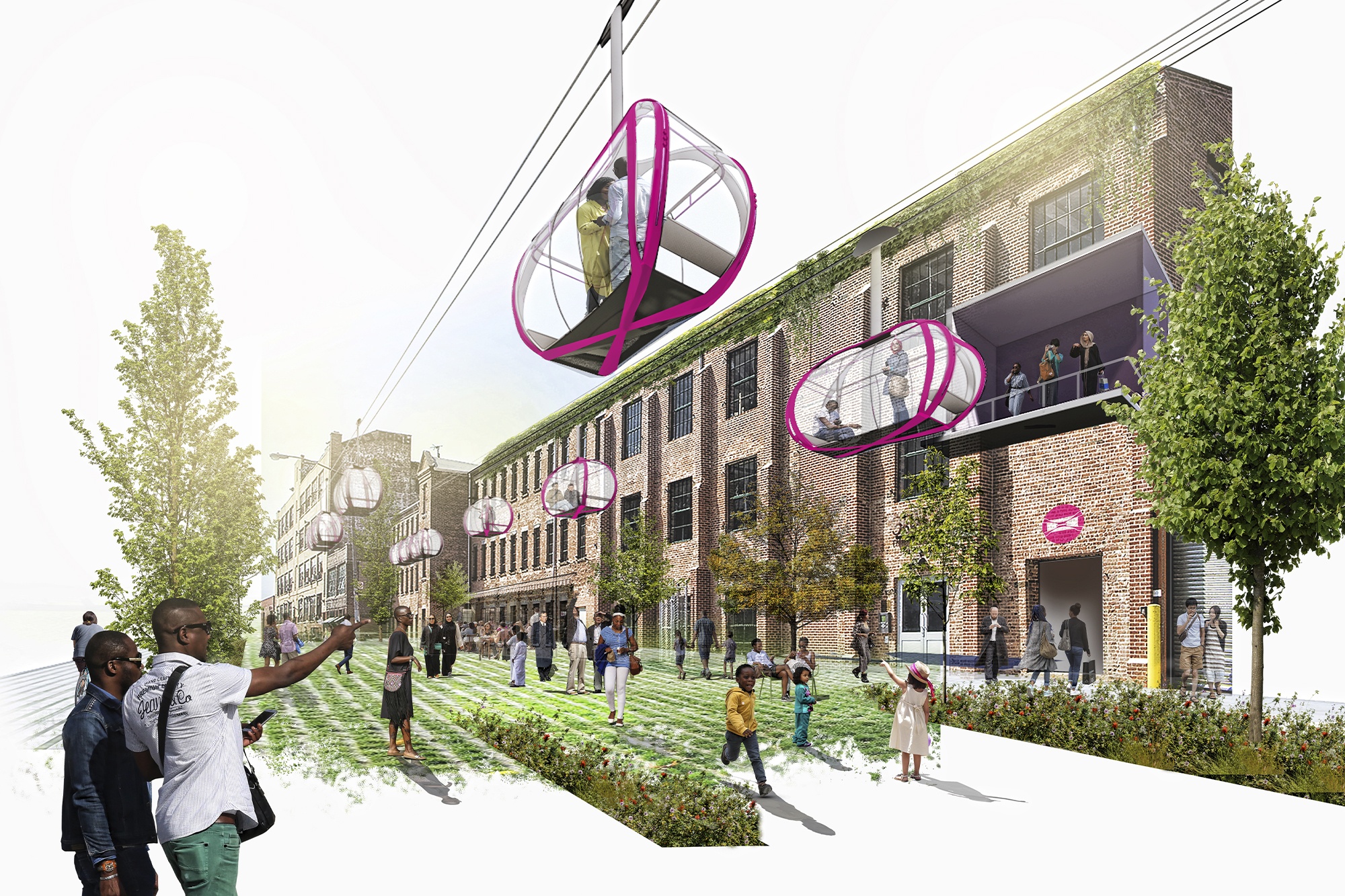
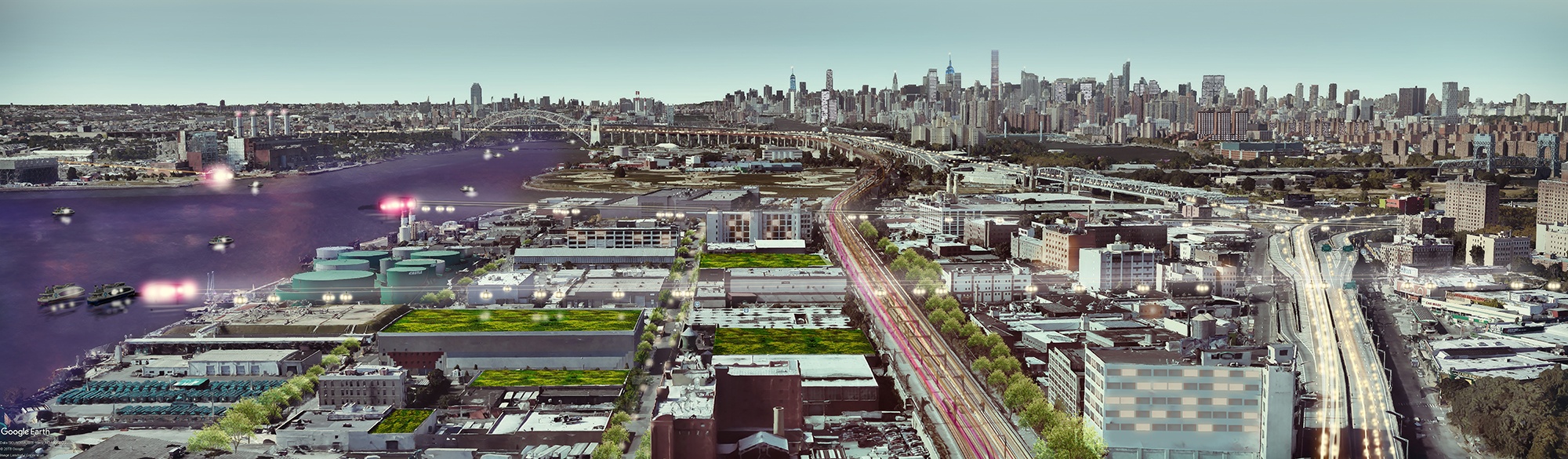
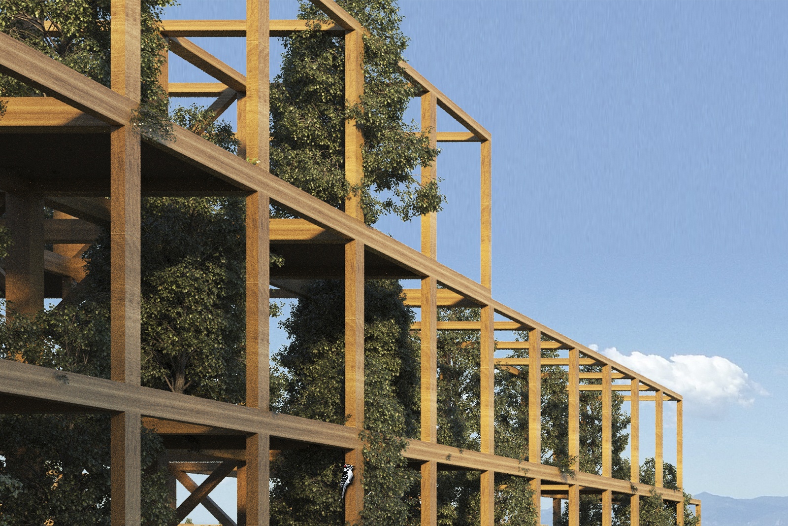
New York City was once a network of self-sustaining enclaves, each with an identity playing part to a whole. As the city evolves, those individual neighborhoods continue to lose some of their identity, growing more dependent on Manhattan’s Central Business Districts (CBD) and the transit networks that serve them. Through this competition entry, Dattner Architects explores and proposes deconcentrating our CBDs through strategies that catalyze and encourage development of underserved neighborhoods.
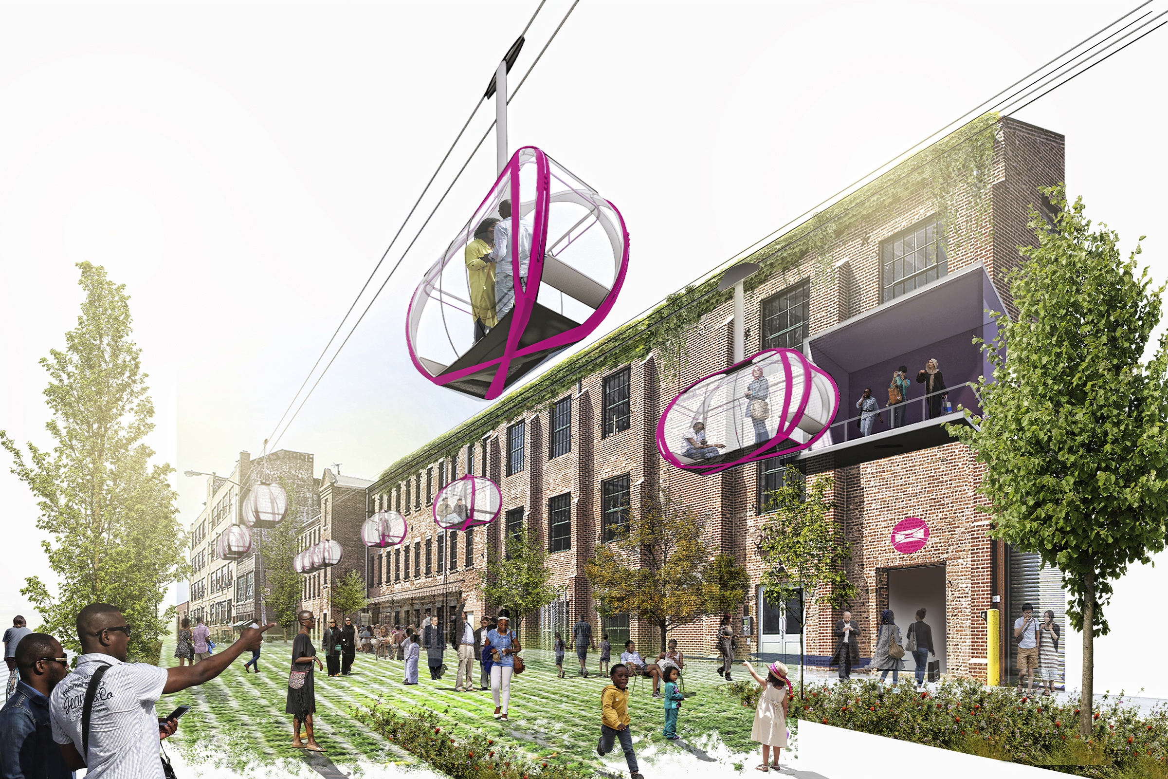
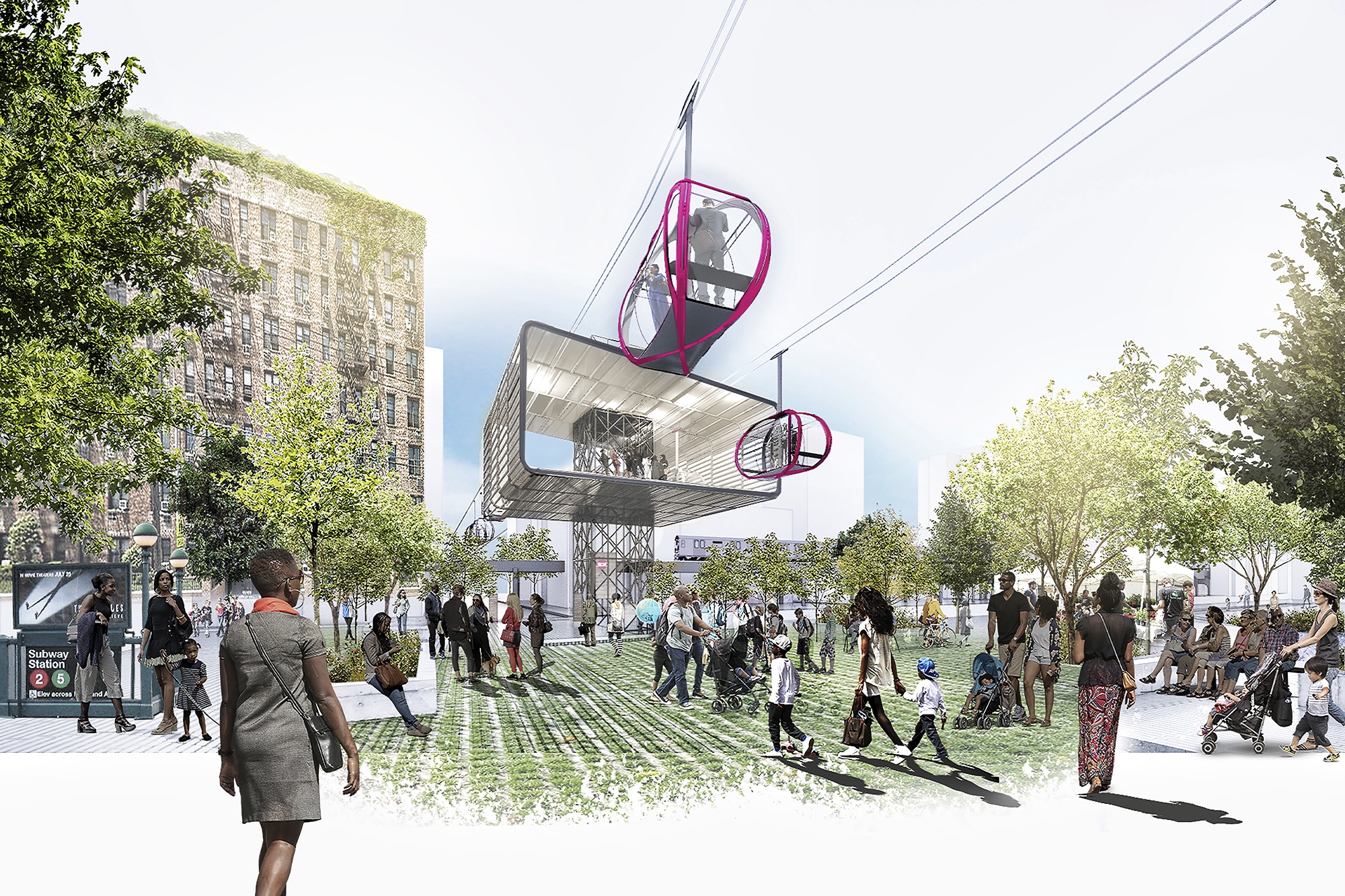
Everyone’s transit journey starts and ends beyond a transit station or stop; these are the “first- and last-mile” connections. Many communities that lack access to the larger transit network have insufficient first- and last-mile options, resulting in an inequity in the journey between home, workplace, and other destinations for too many residents.
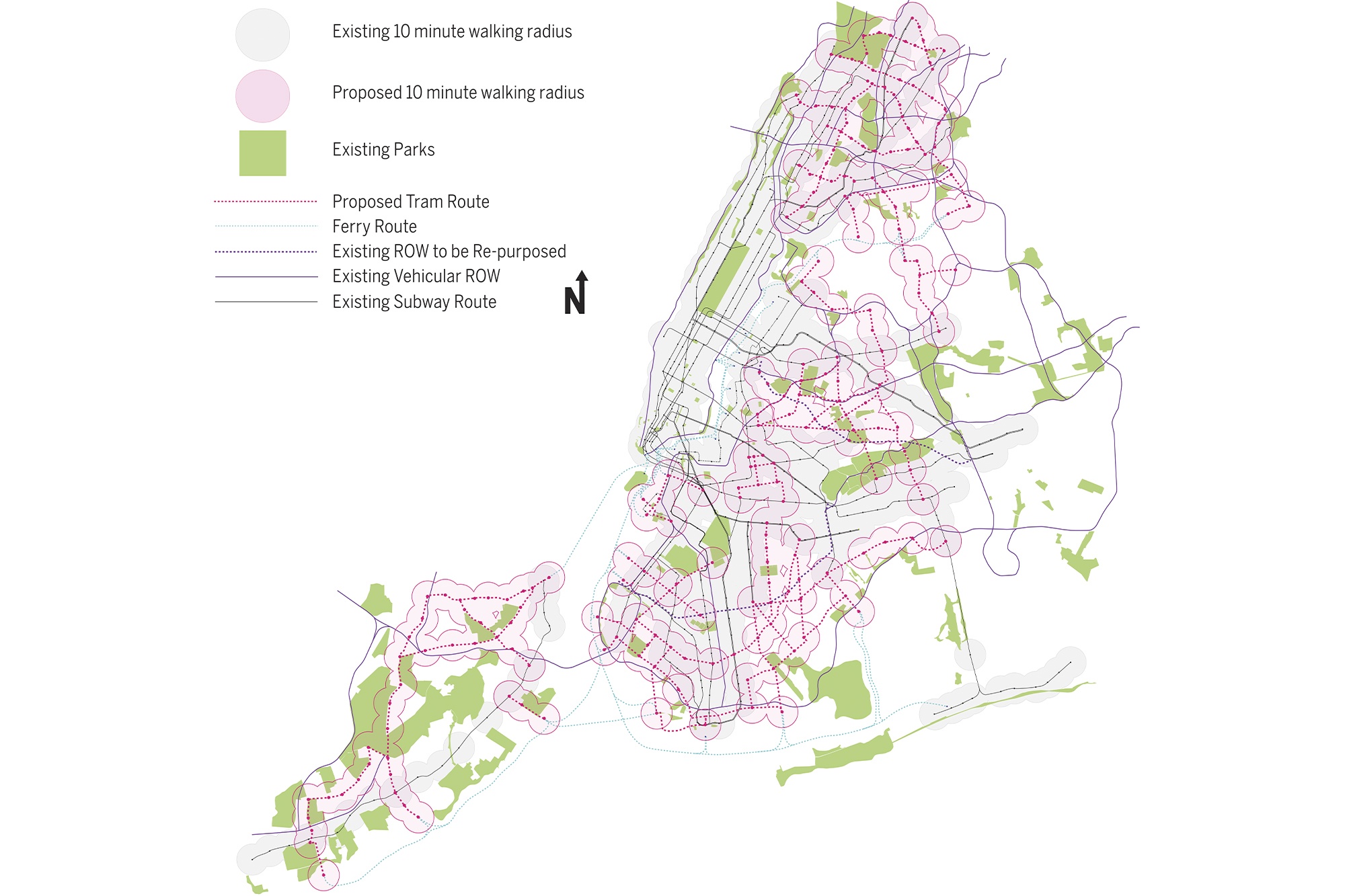
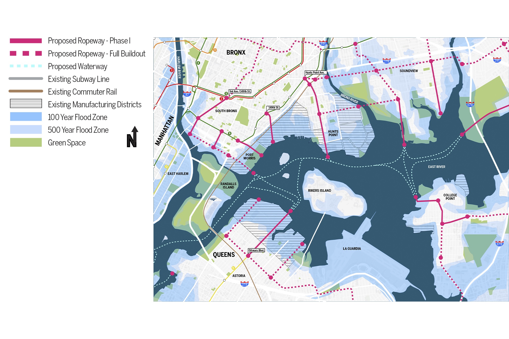
Our plan identifies the gaps in this access, and recommends flexible, scalable, inexpensive infrastructure solutions to be deployed along vacant right-of-ways in coordination with available, automated technologies to link existing transit routes. With a more robust and resilient transit network, neighborhoods can thrive with more diverse job opportunities, local amenities, and scales of housing—supporting a life and identity apart from the CBD.
New York City was once a network of self-sustaining enclaves, each with an identity playing part to a whole. As the city evolves, those individual neighborhoods continue to lose some of their identity, growing more dependent on Manhattan’s Central Business Districts (CBD) and the transit networks that serve them. Through this competition entry, Dattner Architects explores and proposes deconcentrating our CBDs through strategies that catalyze and encourage development of underserved neighborhoods.
Everyone’s transit journey starts and ends beyond a transit station or stop; these are the “first- and last-mile” connections. Many communities that lack access to the larger transit network have insufficient first- and last-mile options, resulting in an inequity in the journey between home, workplace, and other destinations for too many residents.
Our plan identifies the gaps in this access, and recommends flexible, scalable, inexpensive infrastructure solutions to be deployed along vacant right-of-ways in coordination with available, automated technologies to link existing transit routes. With a more robust and resilient transit network, neighborhoods can thrive with more diverse job opportunities, local amenities, and scales of housing—supporting a life and identity apart from the CBD.